Sightseeing is fun for just about anyone, lots of people can’t afford to go on elaborate vacations. What if you could see the hottest sites without needing to leave the comfort of your own home, or office?
Google’s Maps with Street View have been ever expanding, allowing us to view the streets of our most desired places to visit.
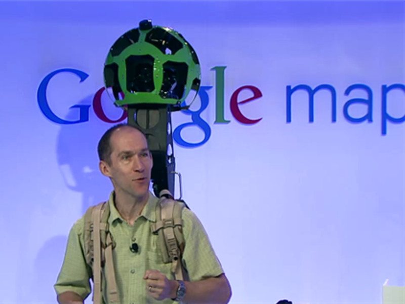
Google has several different cameras that they use to bring us Street View, primarily using the car, other cameras are the trolley, and snowmobile. Today they are using the Trekker, a wearable backpack, a portable camera system that is able to gather images while the wearer travels on foot through harsh terrain and to locations difficult to get to. The Trekker has a total of 15 cameras angled around to give a 360-degree panoramic view. Taking a photo every two and a half seconds.
We learn from Mashable that today Google Japan uploaded a video to their YouTube page showing us that there is now a Street View of Mount Fuji. Mount Fuji is the tallest mountain in Japan, which reaches a height of 12,389 feet into the sky.
Mount Fuji is an active volcano, only accessible by foot making it a perfect candidate for the trekker, the 3,776 meter hike has already been uploaded to Google Map servers and is viewable here.
This street view is not only great to see the scenery but also to be used as a guide if you are planning to climb Mount Fuji anytime soon.
Photo from engadget
Apacer is a leading name for high-performance storage and memory, and now with the release…
Corsair already has the enthusiast market taken care of, with one of the most comprehensive…
The wealth of incredible RTX Remix mods has been pretty amazing, as we've seen so…
SteelSeries has always had some of the absolute best gaming headsets on the market, spanning…
There are now over 500 games and applications that feature RTX technologies, and that number…
Total War: Warhammer III is one of those games that have an endless amount of…